
Warm, dry winter in Sisters Country?
Last updated 12/18/2018 at Noon
Jerry Baldock
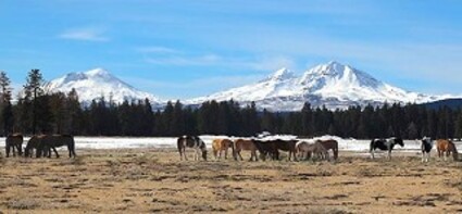
The peaks of the Central Oregon Cascade mountains sport a blanket of snow, but there’s none to be found at lower elevations just yet. That may be the kind of winter that’s in store for Sisters Country.
Earlier in the fall climate forecasters began to speculate about the kind of weather the Pacific Northwest might experience this winter. On September 20, Pete Parsons, meteorologist for the Oregon Department of Agriculture in Salem, issued a forecast for the period October through December. It called for October to start out relatively quiet, turning more stormy by the end of the month and continue through December. Although his forecast was primarily targeted for the area west of the Cascades in Washington and Oregon, a look at the data for Sisters during this period offers an insight into the broad-scale weather pattern.
The precipitation total for October was more than half an inch below normal. Only two minor frontal systems even approached our region. Temperatures were slightly cooler than average. A high pressure ridge kept storms at bay for the first two-thirds of November before finally breaking down and allowing about an inch of rain to fall during the remainder of the month. The moisture deficit for November was a full inch. Maximum daily temperatures were about 3º F above normal while minimum temperatures averaged 4º F below average, consistent with the high frequency of cloudless skies.
December started off cold and dry as the thermometer fell to 2º F on December 7 and 8. An active front finally made it across the mountains and deposited nearly half an inch of rain in Sister Country on December 12.
When Parsons released his forecast the El Niño Southern Oscillation (ENSO) signal was neutral; neither an El Niño nor a La Niña was in play, and he was of the opinion that condition would perhaps continue into mid-to-late winter.
Meanwhile, the National Oceanic and Atmosphere Administration's (NOAA) Climate Prediction Center (CPC) was at work formulating their version of the upcoming winter season. Their winter outlook December through February was for above-average temperatures across the northern and western regions of the U.S., including Alaska and Hawaii. In addition, they felt there was a 70 to 75 percent chance of an El Niño developing.
"We expect El Niño to be in place in late fall to early winter," said Mike Halpert, deputy director of NOAA's CPC.
Why was the CPC so sure an El Niño was coming when the surface temperature of the water in the ocean was about average? The answer is an interesting one.
An April 9 image of sea level height from the Jason-3 satellite showed most of the ocean at normal heights. By the beginning of May, however, high sea levels began to build up in the central Pacific. In the tropics, high sea levels are usually caused by a layer of warm water at or below the surface. In this case, the warmer water was beneath the surface.
The patch of high sea level slowly propagated eastward through the tropical Pacific Ocean along the equator. Known as a downwelling Kelvin wave, this phenomenon is often a precursor to an El Niño event. Much of the warmer water has now worked its way to the surface, as if to declare that El Niño is here.
And indeed it is.
The latest three-month average (September through November) of the Oceanic Niño Index (ONI) is 0.7, surpassing the 0.5 threshold for an El Niño. Although it's currently a weak one, it will likely last through the winter into early spring.
Based on this early arrival of El Niño, Parsons has factored that piece of information into his revised December 2018 through February 2019 forecast, which came out on November 20.
"A classic 'split-flow' jet stream pattern, typical of El Niño events, is expected for this winter," explains Parsons. What this means is that the winds aloft tend to diverge just off the coast, shearing apart incoming Pacific storms and sending most of the energy northward into Canada or Alaska and to the south toward California. We're already starting to see this tendency in the forecasting models.
The chance of high amplitude buckling of the jet stream that sometimes results in prolonged periods of extreme cold spells is significantly reduced during El Niño regimes.
Parsons' bottom line is to expect rainfall and mountain snowpacks to be below average for the winter. Temperatures should run above normal, except in low elevations where inversions tend to form and persist.
The fact that the CPC and Parsons (and others) seem to be on the same forecasting page should boost confidence that Sisters Country is probably headed for yet another warm and dry winter.


Reader Comments(0)