
News and Opinion from Sisters, Oregon
News and Opinion from Sisters, Oregon
The land of Deschutes County, like other counties, is divided up into interesting shapes. A school district here, a parks and recreation district there, a House of Representatives district that might change from District 2 to District 5. Maps for land use zoning determine whether folks can develop their properties, whether they must grow trees or agriculture, or whether it's suitable for industrial use. What about evacuation zones?
This reporter made five web searches and seven phone calls to various fire departments, ranger stations, and county departments before finding the answer to the question: How can a Deschutes County resident look up their evacuation zone? The easiest way seems to be a third-party website called Genasys Protect (see "Resources for Evacuation Zone and Fire Awareness," below).
Genasys states that "all zones in Genasys Protect are published by the county and are authoritative. Genasys works directly with each county we serve and all information for a zone or county listed on the site has been approved by the county."
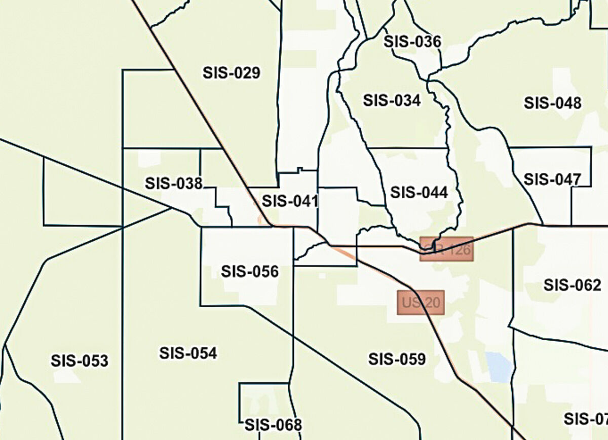
Sisters Country is divided into a multitude of evacuation zones.
The first three letters represent the name of the city, in this case SIS for the city of Sisters and surrounding areas. The last three numbers form a unique code that distinguishes one evacuation zone from the others in the same area.
"This system is consistent across your county and makes it easy for first responders to plan and execute evacuations," according to Genasys Protect. Similar to how airports are named, "the zone identifier system provides each zone with a globally unique ID so there is no confusion about which zone is being referred to."
Occasionally, usually during an active emergency, authorities will split an existing evacuation zone into smaller parts. One Sisters Country zone, SIS-056, might be split into SIS-056-A and SIS-056-B, for example.
Recent searches on Genasys showed evacuation zones for Deschutes, Jackson, and Josephine Counties in Oregon, along with a tiny slice of Jefferson near Panorama Park and a considerable chunk of Klamath County.
The maps on Genasys are accompanied by descriptions. For example, Zone SIS-033 includes "areas Northeast of Sisters including the airport, Eagle Air Estates, & Barclay Meadows." Much of Southwest Sisters is designated SIS-056, including areas south of Hwy 242, west of Elm Street, and north of Brooks Scanlon Logging Road. Between the maps and the words, determining the evacuation zone of any given location is fairly simple.
Some outlying areas have their own evacuation zones: if we leave off the "SIS" appellation, Tollgate is 028, Crossroads is 052, and Whychus Creek Canyon Estates comprises most of 023. Black Butte Ranch encompasses a whopping three zones of its own: 004, 006, and 007.
In Sisters Country, evacuations are carried out by Deschutes County Sheriff Office (DSCO) and the United States Forest Service (USFS). According to Ian Reid, Sisters District Ranger, DSCO handles evacuations of most private land in the county.
Reid said on July 25 that this season, "There have been no evacuations in Sisters Country up to now."
As for Deschutes National Forest itself, in an evacuation situation USFS "would close a section, then do sweeps" to ensure that people in the forest got out.
Evacuations require a flexible dance between DSCO and USFS.
Reid said, "It's complicated. It kind of all depends." He described the process as integrated, saying that the two agencies "work really well together."
"We work closely with DSCO to evacuate areas such as campgrounds," he added.
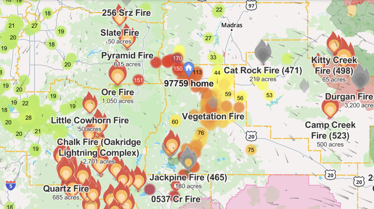
Watch Duty allows users to overlay various sources of information, such as current fires, air quality, and air currents. Drilling down or zooming in will show more fires and include information such as each fire's name and evacuation status, if any.
Even if you know your evacuation zone and receive alerts on your phone, it's important to note that evacuation routes-the specific roads people should take as they evacuate their danger zone-change during fire events. For additional resources and alert signups, see "Resources for Evacuation Zone and fire awareness" below.


Reader Comments(0)